WHERE WE WORK
THE BRIDGER-TETON NATIONAL FOREST
The Bridger-Teton National Forest (BTNF) is located in western Wyoming and totals 3.4 million acres, making it the second largest National Forest outside Alaska. The BTNF stretches south from Yellowstone National Park to the southern end of the Wind River Range, with boundaries of Grand Teton National Park to the west and the slope of the Continental Divide to the east. It also encompasses the Salt River Range, Snake River Range and Wyoming Range. Located within the Forest are the Gros Ventre, Bridger and Teton Wilderness areas totaling 1.3 million acres. The presence of both the Palisades and Shoal Creek Wilderness Study Areas along with 1.5 million acres of roadless land make this Forest a priority landscape for us. There is incredible potential to protect these wildlands within the Wilderness Preservation System and ensure their wilderness character for generations to come. Currently WWA is focusing efforts on the upcoming Forest Plan revision where agency level recommendations would provide important momentum for additional congressionally designated Wilderness, and strong management guidelines for wildlands Forest wide. For more information on our work on the BTNF, please contact our BT Organizer.

SHOSHONE
NATIONAL FOREST
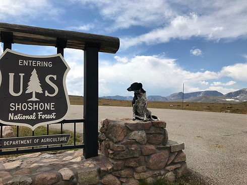
The Shoshone National Forest, the nation's first and one of its wildest, spans 2.4 million acres within the Greater Yellowstone Ecosystem, supporting vital wildlife populations and migration routes. Known as the "Horse Forest," its rugged frontcountry is as wild as its designated Wilderness areas. Wyoming Wilderness Association played a key role in protecting the Shoshone's pristine lands through a decade-long Forest Plan revision finalized in 2015, securing non-motorized protections. The Forest Plan outlined potential uses, but upcoming Travel Planning will decide the future of its roadless and recreation areas.
To Learn more about the current state of the Shoshone National Forest Travel Plan and potential action in the near future, click below.
BIGHORN NATIONAL FOREST
Rock Creek Recommended Wilderness was part of the original proposed Cloud Peak Wilderness Area in the Bighorn National Forest (BNF) but was removed from congressional recommendation for the Wyoming Wilderness Act of 1984 due to a lease on the land for oil and gas and the potential for water storage. While the lease is no longer current and Rock Creek contains no roads or motorized usage, this pristine area has yet to be given wilderness designation by Congress. Currently, WWA is still working to find a solution to include this area in the National Wilderness Preservation System. WWA continues to take outings and assists in stewardship efforts in this fabulous area to keep the conversation of future designation on the table. For a full update on this long standing campaign or to express your support of Rock Creek being added to the Cloud Peak Wilderness, please contact aaron@wildwyo.org.
BLM Wildlands
There are more than 18 million acres of public lands administered by the U.S. Bureau of Land Management (BLM) in Wyoming. These landscapes are typically at lower elevations than many National Forest lands in the state and, as a result, are characterized by their arid or semi-arid ecosystems. Badlands, dune fields, rock outcrops, alkali flats, and sagebrush sea characterize the majority of Wyoming BLM land. Despite their arid, rugged nature, they are also some of the most intact ecosystems left in the US and support a surprising amount of biological diversity and richness. Many of these lands remain undeveloped and yet, by the same token, they also remain relatively unprotected.
Unfortunately, these wild arid landscapes are often rich in mineral and renewable energy resources as well as increasingly alluring to both motorized and non-motorized outdoor recreationists and therefore remain perpetually in the crosshairs of energy developers, the outdoor recreation industry, and political entities who prioritize economic growth over ecosystem and landscape resilience. WWA recognizes these lands are integral to the resilience of Wyoming communities both for their economic contributions as well as the respite and recreational opportunities they provide. WWA is working hard to ensure that development and multiple use of these lands is carefully planned to preserve their ecological vitality and wild character while also supporting resilient communities and economies, so that these lands remain both wild, and working.
Rock Springs RMP: Laying the Foundation for the Future of Wyoming’s Red Desert
Wyoming’s Northern Red Desert is a vast expanse of public lands composed of the largest living dune field in North America, colorful badlands, huge swaths of sagebrush country boasting the largest population of sage-grouse in the world, serpentine canyons, and immense open spaces all beneath an immense, clear sky. Bisected by the Oregon Trail and the longest mule deer migration corridor on Earth, this landscape contains cultural and historical sites for Indigenous peoples and early western pioneers, vital wildlife habitat, and incredible opportunities for recreation and reflection in absolute solitude. A significant portion of the Red Desert falls under the jurisdiction of the Rock Springs Field Office of the BLM. The Rock Springs Field Office has been in the process of revising their land use plan, also known as a resource management plan, for over a decade. WWA has been involved in this lengthy process since its inception in 2011, advocating for the future of Red Desert wildlands.

Our Arid Wildlands Program Manager spent several months interviewing two local Red Desert experts about their experiences in the Red Desert. Listen in on these conversations either remotely from your desktop, or as you drive the scenic corridor of Highway 28 between Lander and Farson, Wyoming with the free app from TravelStorysGPS.
Adventure the Red Desert via TravelStorys below. Or download the app here.
Red Desert TravelStorys
THE PALISADES WILDERNESS STUDY AREA
Within the last few decades, a love for motorized and mechanized recreation has created a wave of opposition to the protections provided by the Wilderness Act of 1964. As this conflict spreads across the west and around the globe, our film The Palisades Project uses a little known wild landscape located in the northwest corner of Wyoming to expose this issue and inspire opposing sides towards a solution.

