
Wildland Spotlight : Cedar Mountain WSA
- Sarah Walker
- Feb 13, 2024
- 1 min read
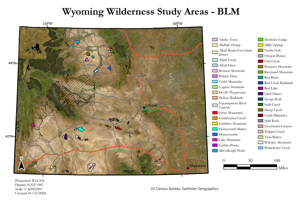
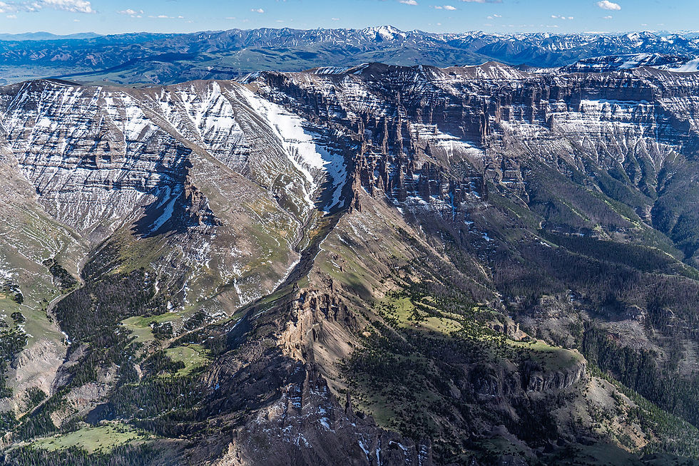
The Cedar Mountain Wilderness Study Area (WSA) encompasses about 21,500 acres of specially protected BLM lands in Washakie and Hot Springs counties. This Bighorn Basin WSA in between the towns of Thermopolis and Worland provides opportunities for naturalness, solitude, and primitive and unconfined recreation. Cedar Mountain is the area's major landmark, and the topography is characterized by deep, steep-sided drainages flowing toward the Bighorn River, with elevations ranging from 4200 to 5500 feet. Fossilized reptiles and petrified wood are exposed in the Meteetse and Lance formations and mammalian fossils have been discovered in the Fort Union formation.* The area provides important habitat and hunting opportunities for a variety of wildlife, including raptor nesting sites. Over 27 Tribes claim ancestral ties to the area and Northern Arapahoe and Eastern Shoshone tribal members rely on the area's natural and cultural resources today.

Cedar Mountain WSA
Current threats and opportunities
10,000 acres of Cedar mountain have been recommended for wilderness by the BLM, and oil and gas potential in the area is low. Senator Barrasso's Wyoming Public Lands Initiative Act of 2023 would release the area from it's Wilderness Study Area protections and establishment special management provisions recommended by the Wyoming Public Lands Initiative.
Additional Resources
*Wild Wyoming, A Falcon Guide, Erik Molvar, 2001


This blog is really helpful. I found the information I was looking for by visiting your blog. Come back to play fun new games if you have time. A popular game among many persons is: quordle today
Thank you for providing such detailed and useful content. This blog helped me understand the financial assistance options available for small businesses. The way you explained the objectives and benefits of Pradhan Mantri Mudra Yojana is truly commendable. It’s encouraging to see such informative posts that guide aspiring entrepreneurs. Keep sharing more content like this—it really makes a difference.
We are thankful for Sukanya Samriddhi Yojana, a valuable step toward ensuring financial protection for daughters. This savings plan not only provides strong returns but also motivates families to build a solid financial foundation. Thank you for introducing a scheme that prioritizes education and empowerment.
The Cedar Mountain WSA looks like an amazing spot for anyone seeking solitude and a deep connection with nature. The vast, unspoiled landscapes are perfect for primitive recreation and adventure. Truly inspiring! Also, for those in the city looking for companionship, Independent Ekkaduthangal Call Girls offer reliable services.
Always watch the mixing meter carefully—undermixed or overmixed sundaes lead to unhappy customers papa's freezeria.